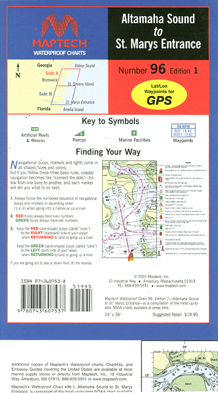
Altamaha Sound to St. Mary's Entrance Waterproof Chart, 1st Edition
Explore the rich waterways of southern Georgia with the Altamaha Sound to St. Mary's Entrance Waterproof Chart, 1st Edition, by Richardson's Maptech. This meticulously crafted chart is essential for both novice and experienced boaters navigating the scenic sounds and rivers along the Intracoastal Waterway (ICW). Its user-friendly design offers clarity and precision, ensuring safe travels across these beautiful waterways.
The chart features an approximate scale of 1:53,333, providing an accurate representation of the area to assist with navigation. With pre-plotted GPS waypoints and courses, you can easily plot your journey and stay on course, allowing you to focus on enjoying the beautiful surroundings.
Key features of this Waterproof Chart include:
- Detailed illustrations of local gamefish, making it ideal for fishing enthusiasts.
- Information on marine facilities, boat ramps, and artificial reefs to enhance your boating experience.
Moreover, it contains valuable safety information to ensure your adventures are both enjoyable and secure. Whether you're embarking on a weekend getaway or a longer fishing expedition, this Waterproof Chart is your reliable companion on the water.
Your next adventure awaits on the waters of southern Georgia. Don't miss out on this indispensable tool for navigation. Order your Altamaha Sound to St. Mary's Entrance Waterproof Chart today and set sail with confidence!
Original : $27.95
-70%$27.95
$8.38Description
Explore the rich waterways of southern Georgia with the Altamaha Sound to St. Mary's Entrance Waterproof Chart, 1st Edition, by Richardson's Maptech. This meticulously crafted chart is essential for both novice and experienced boaters navigating the scenic sounds and rivers along the Intracoastal Waterway (ICW). Its user-friendly design offers clarity and precision, ensuring safe travels across these beautiful waterways.
The chart features an approximate scale of 1:53,333, providing an accurate representation of the area to assist with navigation. With pre-plotted GPS waypoints and courses, you can easily plot your journey and stay on course, allowing you to focus on enjoying the beautiful surroundings.
Key features of this Waterproof Chart include:
- Detailed illustrations of local gamefish, making it ideal for fishing enthusiasts.
- Information on marine facilities, boat ramps, and artificial reefs to enhance your boating experience.
Moreover, it contains valuable safety information to ensure your adventures are both enjoyable and secure. Whether you're embarking on a weekend getaway or a longer fishing expedition, this Waterproof Chart is your reliable companion on the water.
Your next adventure awaits on the waters of southern Georgia. Don't miss out on this indispensable tool for navigation. Order your Altamaha Sound to St. Mary's Entrance Waterproof Chart today and set sail with confidence!


