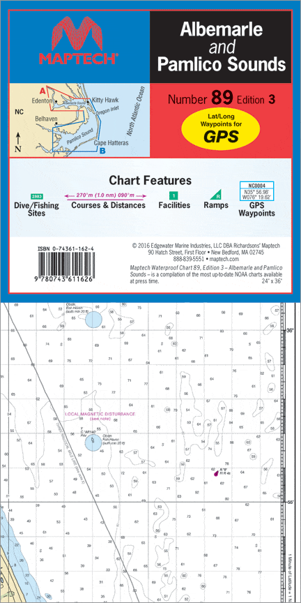
Albemarle & Pamlico Sounds Waterproof Chart, 3rd Edition
Discover the Albemarle & Pamlico Sounds Waterproof Chart, 3rd Edition by Richardson's Maptech. This essential navigational tool is perfect for anyone looking to explore the stunning waterways of North Carolina's coastal area. Designed for boaters, fishermen, and outdoor enthusiasts, this waterproof chart is both durable and easy to read.
This comprehensive chart covers all critical information for safe and enjoyable navigation in the Albemarle and Pamlico Sounds. It features GPS waypoints, courses, and distances, ensuring you can plot your course with precision. Inside, you'll also find important marine facility locations, public boat launch sites, and designated dive and fishing spots—everything you need for a successful outing.
- Durability: Made with waterproof materials, this chart is designed to withstand the elements, making it an ideal choice for marine adventures.
- Easy Navigation: The scale of 1:113,000 and 1:107,000, combined with insets, provides detailed information to help you navigate safely.
At a size of 24" X 36", this waterproof chart is conveniently sized for both onboard reference and planning. Maximize your exploration and fishing trips with the information at your fingertips. Don’t set sail without a reliable chart!
Original : $27.95
-70%$27.95
$8.38Description
Discover the Albemarle & Pamlico Sounds Waterproof Chart, 3rd Edition by Richardson's Maptech. This essential navigational tool is perfect for anyone looking to explore the stunning waterways of North Carolina's coastal area. Designed for boaters, fishermen, and outdoor enthusiasts, this waterproof chart is both durable and easy to read.
This comprehensive chart covers all critical information for safe and enjoyable navigation in the Albemarle and Pamlico Sounds. It features GPS waypoints, courses, and distances, ensuring you can plot your course with precision. Inside, you'll also find important marine facility locations, public boat launch sites, and designated dive and fishing spots—everything you need for a successful outing.
- Durability: Made with waterproof materials, this chart is designed to withstand the elements, making it an ideal choice for marine adventures.
- Easy Navigation: The scale of 1:113,000 and 1:107,000, combined with insets, provides detailed information to help you navigate safely.
At a size of 24" X 36", this waterproof chart is conveniently sized for both onboard reference and planning. Maximize your exploration and fishing trips with the information at your fingertips. Don’t set sail without a reliable chart!


