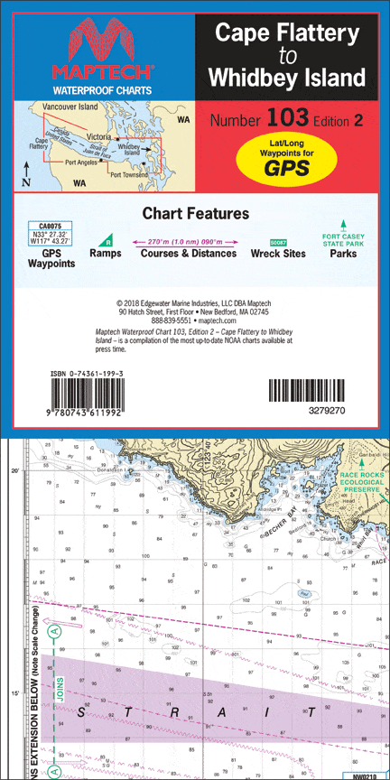
Cape Flattery to Whidbey Island Waterproof Chart, 2nd Edition
Explore the stunning waters of the Strait of Juan De Fuca with the Cape Flattery to Whidbey Island Waterproof Chart, 2nd Edition. This chart is expertly designed for both casual boaters and seasoned navigators, featuring detailed insights from Dungeness Bay to Port Townsend.
Our Waterproof Chart is essential for navigating the region’s intricate waterways. With a detailed scale of approximately 1:106,600 and 1:53,300, this chart includes invaluable information to ensure a safe and enjoyable journey on the water.
Key benefits of the Cape Flattery to Whidbey Island Waterproof Chart include:
- Comprehensive waypoints for major buoys and channels, ensuring you stay on course.
- Access to public boat launch locations, making it easy to plan your adventure.
- Useful state park information that helps you discover beautiful destinations along the coastline.
This waterproof chart is not only durable but also easy to read, making it perfect for on-the-water use. Whether you are planning a fishing trip, sailing excursion, or simply exploring the beautiful coastline, this chart is your reliable companion.
Original : $27.95
-70%$27.95
$8.38Description
Explore the stunning waters of the Strait of Juan De Fuca with the Cape Flattery to Whidbey Island Waterproof Chart, 2nd Edition. This chart is expertly designed for both casual boaters and seasoned navigators, featuring detailed insights from Dungeness Bay to Port Townsend.
Our Waterproof Chart is essential for navigating the region’s intricate waterways. With a detailed scale of approximately 1:106,600 and 1:53,300, this chart includes invaluable information to ensure a safe and enjoyable journey on the water.
Key benefits of the Cape Flattery to Whidbey Island Waterproof Chart include:
- Comprehensive waypoints for major buoys and channels, ensuring you stay on course.
- Access to public boat launch locations, making it easy to plan your adventure.
- Useful state park information that helps you discover beautiful destinations along the coastline.
This waterproof chart is not only durable but also easy to read, making it perfect for on-the-water use. Whether you are planning a fishing trip, sailing excursion, or simply exploring the beautiful coastline, this chart is your reliable companion.


