1 / 2
Tampa Bay to Tarpon Springs Waterproof Chart, 4th Edition
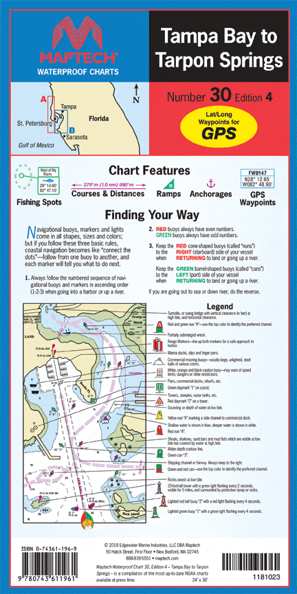
Tampa Bay and coast to Port Richey. Featuring waypoints for major buoys, courses and distances, fishing sites, anchorages, and ramp locations. 24" x 36", scale 1:53,000 with insets.
Tampa Bay and coast to Port Richey. Featuring waypoints for major buoys, courses and distances, fishing sites, anchorages, and ramp locations. 24" x 36", scale 1:53,000 with insets.
$8.38
Original : $27.95
-70%Tampa Bay to Tarpon Springs Waterproof Chart, 4th Edition—
$27.95
$8.38Description
Tampa Bay and coast to Port Richey. Featuring waypoints for major buoys, courses and distances, fishing sites, anchorages, and ramp locations. 24" x 36", scale 1:53,000 with insets.


