1 / 2
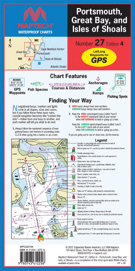
Portsmouth, Great Bay, and Isles of Shoals Waterproof Chart, 4th Edition
Great Bay and Piscataqua River to Isles of Shoals. Featuring GPS Waypoints, courses and distances, ramp locations, state parks, and fishing areas. 24" x 36", scale 1:26,666 with insets.
Great Bay and Piscataqua River to Isles of Shoals. Featuring GPS Waypoints, courses and distances, ramp locations, state parks, and fishing areas. 24" x 36", scale 1:26,666 with insets.
$8.38
Original : $27.95
-70%Portsmouth, Great Bay, and Isles of Shoals Waterproof Chart, 4th Edition—
$27.95
$8.38Description
Great Bay and Piscataqua River to Isles of Shoals. Featuring GPS Waypoints, courses and distances, ramp locations, state parks, and fishing areas. 24" x 36", scale 1:26,666 with insets.


