1 / 2
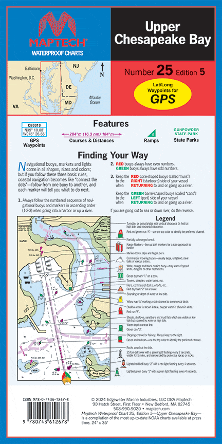
Upper Chesapeake Bay Waterproof Chart, 5th Edition
C&D Canal to the Potomac River. Featuring waypoints for major buoys, courses and distances, and ramp locations and information. Great planning chart. 24 x 36, scale 1:114,000.
C&D Canal to the Potomac River. Featuring waypoints for major buoys, courses and distances, and ramp locations and information. Great planning chart. 24 x 36, scale 1:114,000.
$8.38
Original : $27.95
-70%Upper Chesapeake Bay Waterproof Chart, 5th Edition—
$27.95
$8.38Description
C&D Canal to the Potomac River. Featuring waypoints for major buoys, courses and distances, and ramp locations and information. Great planning chart. 24 x 36, scale 1:114,000.


