1 / 2
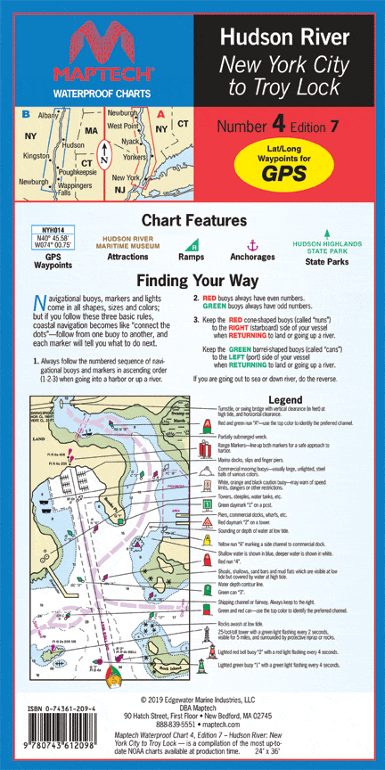
Hudson River Waterproof Chart, 7th Edition
New York City and Liberty Island to the Troy Lock. The best Hudson River chart! Featuring ramp locations, information and historic sites. 14" x 60", scale 1:53,333.
New York City and Liberty Island to the Troy Lock. The best Hudson River chart! Featuring ramp locations, information and historic sites. 14" x 60", scale 1:53,333.
$27.95
Hudson River Waterproof Chart, 7th Edition—
$27.95
Description
New York City and Liberty Island to the Troy Lock. The best Hudson River chart! Featuring ramp locations, information and historic sites. 14" x 60", scale 1:53,333.


