Vintage Style Florida Map (Antique Maps of Florida)
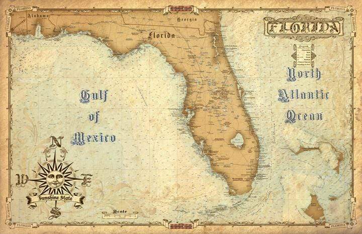
Antique Maps of Florida is the first of a brand new Waterproof Charts vintage series. This map has the latest and greatest high definition information. It shows features such as, cities, roads, nautical information, major points of interest, and much much more, with an antique, vintage feel. This map is Not Waterproof and is NOT for Navigation, it’s printed on high quality #80 stock. Size: 22” x 34”
Antique Maps of Florida is the first of a brand new Waterproof Charts vintage series. This map has the latest and greatest high definition information. It shows features such as, cities, roads, nautical information, major points of interest, and much much more, with an antique, vintage feel. This map is Not Waterproof and is NOT for Navigation, it’s printed on high quality #80 stock. Size: 22” x 34”
$2.98
Original : $9.95
-70%Vintage Style Florida Map (Antique Maps of Florida)—
$9.95
$2.98Description
Antique Maps of Florida is the first of a brand new Waterproof Charts vintage series. This map has the latest and greatest high definition information. It shows features such as, cities, roads, nautical information, major points of interest, and much much more, with an antique, vintage feel. This map is Not Waterproof and is NOT for Navigation, it’s printed on high quality #80 stock. Size: 22” x 34”


