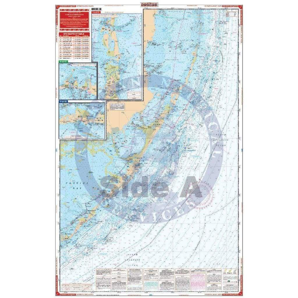
Upper Florida Keys Navigation Chart 33
From Soldier Key and Black Point in Biscayne Bay, this chart covers the entire area south to Marathon with both detailed Intracoastal coverage and offshore coverage showing complete reef details. Also includes complete coverage of Florida Bay and Flamingo Area, and expanded detail insets for North Key Largo, Windley Key (Holiday Isles) Area, Tavenier, Indian Key Area, Marathon and Flamingo.
Contains a total of 15 plotted and indexed GPS Waypoints. Information from 4 NOAA Charts: 11462, 11451, 11442 & 11452. GPS Datum. Chart size is 25" x 38"
Original : $27.95
-70%$27.95
$8.38Description
From Soldier Key and Black Point in Biscayne Bay, this chart covers the entire area south to Marathon with both detailed Intracoastal coverage and offshore coverage showing complete reef details. Also includes complete coverage of Florida Bay and Flamingo Area, and expanded detail insets for North Key Largo, Windley Key (Holiday Isles) Area, Tavenier, Indian Key Area, Marathon and Flamingo.
Contains a total of 15 plotted and indexed GPS Waypoints. Information from 4 NOAA Charts: 11462, 11451, 11442 & 11452. GPS Datum. Chart size is 25" x 38"


