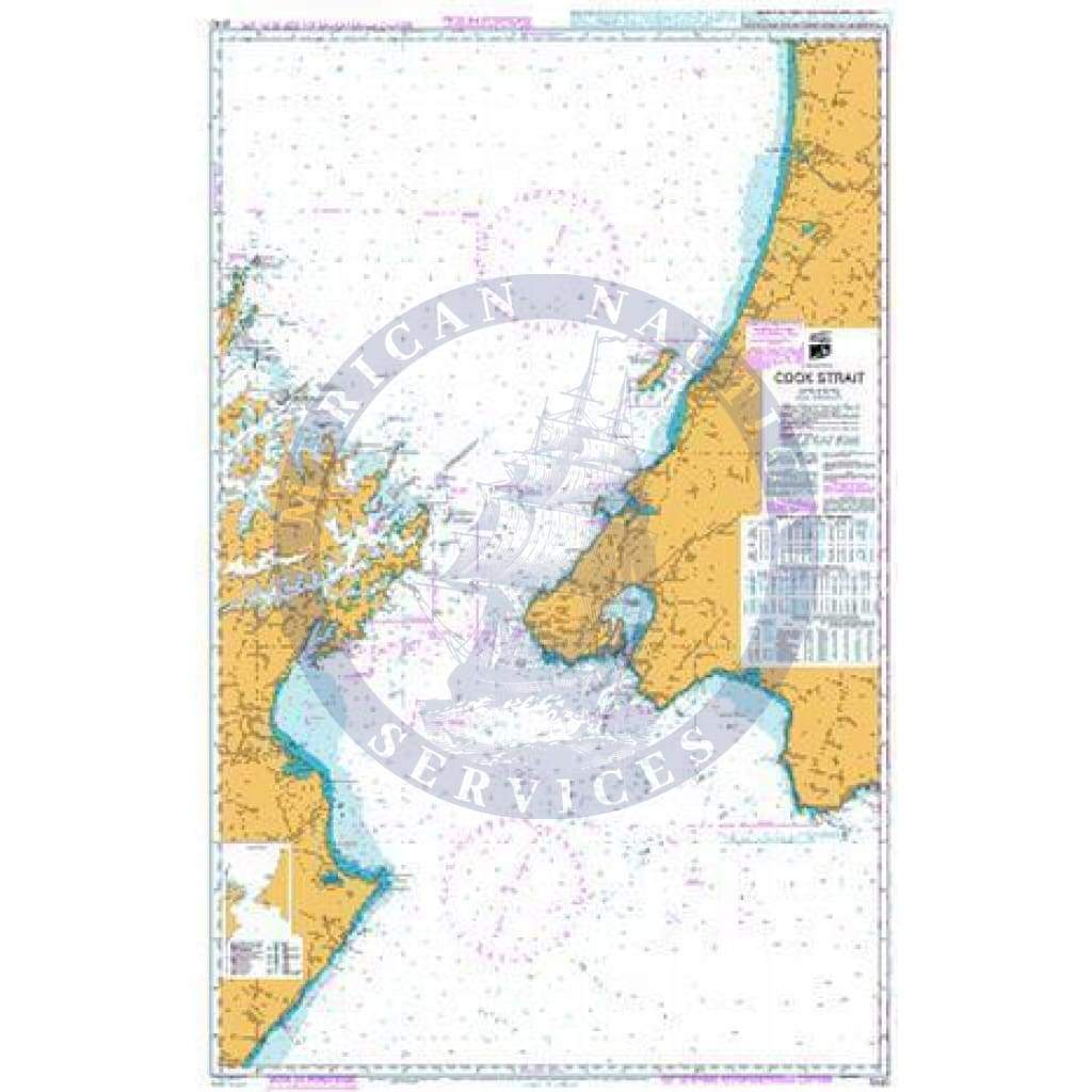
SEMAR Nautical Chart SM363: Río Elota A Mazatlán
SEMAR Nautical Chart SM363: Río Elota A Mazatlán
Scale: 1;100,000
Paper Size: 36.0" x 46.0"
Actual Chart Size: 30.6" x 43.0"
View this Nautical SEMAR Chart
This is an Official Mexican Hydrographic Office chart (SEMAR - Secretaría de Marina-Armada de México). They produce charts for the coastlines and coastal waters of Mexico. This paper chart is printed on demand (POD) through OceanGrafix.
Description
SEMAR Nautical Chart SM363: Río Elota A Mazatlán
Scale: 1;100,000
Paper Size: 36.0" x 46.0"
Actual Chart Size: 30.6" x 43.0"
View this Nautical SEMAR Chart
This is an Official Mexican Hydrographic Office chart (SEMAR - Secretaría de Marina-Armada de México). They produce charts for the coastlines and coastal waters of Mexico. This paper chart is printed on demand (POD) through OceanGrafix.