R.M.S. Rhone Wreck (Historic Maps 18" x 22")
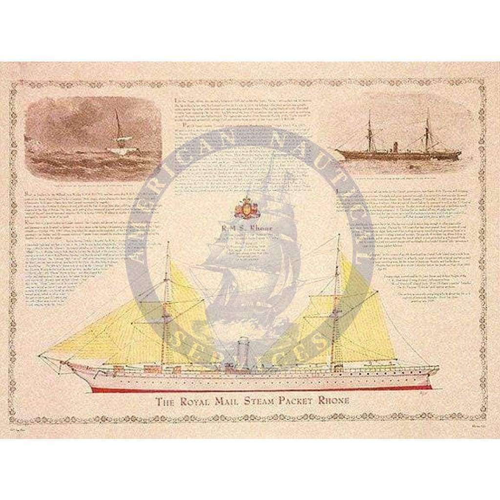
RMSS Rhone was the pride of the Royal Mail Steam Ship Company but came to grief during a disastrous hurricane that struck the Virgin Islands in 1867.
This map features a hull and sail plan drawing based on a contemporary engraving of the vessel and a photograph of her sister ship. Reproduced from letters and reports of the time is an account of the tragedy, which claimed all but six passengers and crew. It also includes the exploits of hardhat divers who successfully salvaged gold bullion and cargo from the wreck.
Original : $10.95
-70%$10.95
$3.28Description
RMSS Rhone was the pride of the Royal Mail Steam Ship Company but came to grief during a disastrous hurricane that struck the Virgin Islands in 1867.
This map features a hull and sail plan drawing based on a contemporary engraving of the vessel and a photograph of her sister ship. Reproduced from letters and reports of the time is an account of the tragedy, which claimed all but six passengers and crew. It also includes the exploits of hardhat divers who successfully salvaged gold bullion and cargo from the wreck.


