TimeZero TZ Map Bahamas-new
Overview
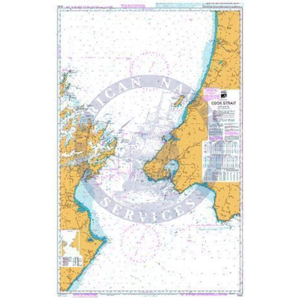
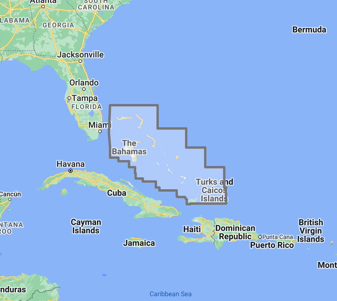
TimeZero TZ Map coverage area showing the Bahamas, Turks and Caicos Islands, and surrounding Caribbean waters
 |
 |
|
|
|
|
|---|---|---|---|---|---|
| Navigate with integrated raster and vector chart data sourced from official hydrographic offices and enriched with detailed nautical features. | Visualize bottom structure with high-resolution bathymetry and BathyVision 3D contour mapping for shallow-water navigation. | Overlay satellite photography with chart data for realistic visual identification of ports, anchorages, and coastal landmarks. | View realistic shoreline altimetry and perspective horizons to identify port entries and channel approaches from offshore. | Customize chart display by toggling between raster imagery, vector layers, bathymetric overlays, and satellite views within TimeZero software. | Compatible with TimeZero Navigator v5 and TimeZero Professional v5, purpose-built for recreational and professional navigation applications. |
![]()

High-Resolution Bathymetry
Navigate Shallow Waters with Confidence
High-resolution bathymetric data transforms chart contour lines into intuitive 3D bottom representations, providing essential depth awareness when navigating into Bahamas ports, anchorages, and reef-lined channels. The graphic interpretation of contour data creates detailed bottom profiles invaluable for approach planning and anchorage selection.
The BathyVision feature displays bottom topography in color and contour line overlays, allowing mariners to dynamically adjust the visualization to suit their navigation needs. This capability is particularly critical in the Bahamas, where shallow banks transition rapidly to deep water, coral heads create isolated hazards within otherwise navigable channels, and popular anchorages require precise depth knowledge for safe ground tackle placement.
Raster and Vector Chart Fusion
Official Charts Enhanced with Intelligent Data Layers
TZ Maps combines two complementary chart formats to deliver maximum navigational confidence. Georeferenced raster data presents true-color digital copies of official hydrographic office paper charts, the same familiar chart view that mariners have relied on for decades. These images provide a reliable visual reference that experienced navigators can interpret immediately.
Vector data operates alongside raster imagery using a database-driven approach that stores information in discrete layers and records every nautical feature independently. This format enables interactive chart queries, object-based search, and depth value interrogation that static raster imagery cannot provide.

Realistic Shoreline Views
Identify Port Entries and Coastal Features from the Horizon
TZ Maps employs altimetry to render shorelines with realistic elevation perspective, creating 3D views that simulate the visual horizon as seen from the bridge. This perspective rendering aids instant identification of port entrances, marina channels, and specific shoreline landmarks during approach.
In the Bahamas, where low-lying islands present minimal visual profile from offshore, realistic shoreline rendering provides valuable situational awareness that flat chart views cannot offer. Mariners can preview the visual profile of their destination before arrival, identifying breakwater positions, channel markers, and adjacent structures in a format that mirrors real-world visual observation.

Detailed Land Information
Understand the Coastline and Nearby Infrastructure
Beyond waterway navigation data, TZ Maps integrates detailed land information that enhances understanding of coastlines and nearby infrastructure. Road networks, settlement locations, and coastal facility positions are rendered alongside maritime chart data.
This integrated land detail is particularly valuable across the remote Bahamas islands, where local knowledge is limited, and mariners may be approaching communities with minimal navigational infrastructure.

Software Compatibility
Purpose-Built for TimeZero Navigation Software
The TZ Map: Bahamas is designed for use with TimeZero navigation software platforms. Compatible applications include:
- TimeZero Navigator v5: Full-featured navigation software for recreational and professional mariners
- TimeZero Professional v5: Advanced navigation platform with commercial vessel capabilities
TZ Maps are delivered as data packs that load directly into compatible TimeZero software installations. This chart pack is not compatible with standalone chartplotters from other manufacturers. Mariners using Garmin, Raymarine, Simrad, or other hardware-based chartplotters should consult the ANS digital charts catalog for compatible chart products.
Complete Your Bahamas Navigation Setup
TimeZero Navigation Software
TZ Maps require compatible TimeZero software. Choose TimeZero Navigator v5 for recreational cruising or TimeZero Professional v5 for advanced commercial navigation features.
Additional TZ Map Regions
Expand coverage beyond the Bahamas with TZ Map data packs for North America, the Caribbean, the Mediterranean, and other global cruising regions. Multiple TZ Map packs load seamlessly within the same TimeZero software installation.
Bahamas Cruising Guides
Supplement digital chart data with detailed anchorage descriptions, approach instructions, and local facility information from dedicated Bahamas cruising guides available through ANS.
ADMIRALTY Paper Charts: Caribbean Coverage
Commercial vessels subject to SOLAS chart carriage requirements should maintain official paper chart backup for primary navigation areas. ADMIRALTY charts covering the Bahamas and Caribbean waters are available through the ANS Chart Selector.
Need Help Choosing the Right Charting Solution?
The ANS navigation team provides personalized guidance on chart selection, software compatibility, and compliance requirements for vessels of all types. Whether outfitting a yacht for Bahamas island-hopping or equipping a commercial vessel for Caribbean routing, ANS specialists match chart products to your vessel, cruising plans, and bridge electronics.
Phone: +1 (954) 522-3321
WhatsApp: +1 (954) 292-4212
Email: [email protected]
Hours: Mon–Fri 8 am–5 pm | Sat 9 am–5 pm EST
FAQs
Q1. What areas does the TZ Map: Bahamas cover?
This chart pack provides navigational coverage across the entire Bahamian archipelago from Grand Bahama south through the Turks and Caicos Islands, including the Abacos, Nassau, Eleuthera, the Exuma Cays, Cat Island, Long Island, and surrounding waters.
Q2. What software is required to use TZ Maps?
TZ Maps require TimeZero Navigator v5 or TimeZero Professional v5 software installed on a compatible computer system. TZ Maps do not operate on standalone chartplotters from other manufacturers.
Q3. Can TZ Maps be used for SOLAS chart carriage compliance?
TZ Maps are designed for navigation planning and situational awareness. Vessels subject to SOLAS Chapter V carriage requirements should verify that their chart products and navigation equipment meet applicable flag state standards. Contact ANS for guidance on SOLAS-compliant chart solutions.
Q4. What chart data types are included in the TZ Map pack?
Each TZ Map pack integrates georeferenced raster charts (official hydrographic office imagery), vector chart data, high-resolution bathymetry with BathyVision 3D display, satellite photography overlay, and detailed land information, including coastline features and infrastructure.
Q5. Can multiple TZ Map regions be used simultaneously?
Multiple TZ Map data packs can be installed within the same TimeZero software environment, providing seamless coverage transitions when navigating between regions. Additional regional packs are available separately through ANS.
Coverage
TZ-Maps: Vector Appearance #1 (For TimeZero Professional V5) | Image by: TimeZero

TZ-Maps: Vector Appearance #2 (For TimeZero Professional V5) | Image by: TimeZero
TZ-Maps: Vector Raster Appearance (For TimeZero Professional V5) | Image by: TimeZero
TZ-Maps: SmartSearch (For TimeZero Professional V5) | Image by: TimeZero
Overview
TimeZero TZ Map coverage area showing the Bahamas, Turks and Caicos Islands, and surrounding Caribbean waters
|
|
|
|
|
|
|---|---|---|---|---|---|
| Navigate with integrated raster and vector chart data sourced from official hydrographic offices and enriched with detailed nautical features. | Visualize bottom structure with high-resolution bathymetry and BathyVision 3D contour mapping for shallow-water navigation. | Overlay satellite photography with chart data for realistic visual identification of ports, anchorages, and coastal landmarks. | View realistic shoreline altimetry and perspective horizons to identify port entries and channel approaches from offshore. | Customize chart display by toggling between raster imagery, vector layers, bathymetric overlays, and satellite views within TimeZero software. | Compatible with TimeZero Navigator v5 and TimeZero Professional v5, purpose-built for recreational and professional navigation applications. |
![]()
High-Resolution Bathymetry
Navigate Shallow Waters with Confidence
High-resolution bathymetric data transforms chart contour lines into intuitive 3D bottom representations, providing essential depth awareness when navigating into Bahamas ports, anchorages, and reef-lined channels. The graphic interpretation of contour data creates detailed bottom profiles invaluable for approach planning and anchorage selection.
The BathyVision feature displays bottom topography in color and contour line overlays, allowing mariners to dynamically adjust the visualization to suit their navigation needs. This capability is particularly critical in the Bahamas, where shallow banks transition rapidly to deep water, coral heads create isolated hazards within otherwise navigable channels, and popular anchorages require precise depth knowledge for safe ground tackle placement.
Raster and Vector Chart Fusion
Official Charts Enhanced with Intelligent Data Layers
TZ Maps combines two complementary chart formats to deliver maximum navigational confidence. Georeferenced raster data presents true-color digital copies of official hydrographic office paper charts, the same familiar chart view that mariners have relied on for decades. These images provide a reliable visual reference that experienced navigators can interpret immediately.
Vector data operates alongside raster imagery using a database-driven approach that stores information in discrete layers and records every nautical feature independently. This format enables interactive chart queries, object-based search, and depth value interrogation that static raster imagery cannot provide.
Realistic Shoreline Views
Identify Port Entries and Coastal Features from the Horizon
TZ Maps employs altimetry to render shorelines with realistic elevation perspective, creating 3D views that simulate the visual horizon as seen from the bridge. This perspective rendering aids instant identification of port entrances, marina channels, and specific shoreline landmarks during approach.
In the Bahamas, where low-lying islands present minimal visual profile from offshore, realistic shoreline rendering provides valuable situational awareness that flat chart views cannot offer. Mariners can preview the visual profile of their destination before arrival, identifying breakwater positions, channel markers, and adjacent structures in a format that mirrors real-world visual observation.
Detailed Land Information
Understand the Coastline and Nearby Infrastructure
Beyond waterway navigation data, TZ Maps integrates detailed land information that enhances understanding of coastlines and nearby infrastructure. Road networks, settlement locations, and coastal facility positions are rendered alongside maritime chart data.
This integrated land detail is particularly valuable across the remote Bahamas islands, where local knowledge is limited, and mariners may be approaching communities with minimal navigational infrastructure.
Software Compatibility
Purpose-Built for TimeZero Navigation Software
The TZ Map: Bahamas is designed for use with TimeZero navigation software platforms. Compatible applications include:
- TimeZero Navigator v5: Full-featured navigation software for recreational and professional mariners
- TimeZero Professional v5: Advanced navigation platform with commercial vessel capabilities
TZ Maps are delivered as data packs that load directly into compatible TimeZero software installations. This chart pack is not compatible with standalone chartplotters from other manufacturers. Mariners using Garmin, Raymarine, Simrad, or other hardware-based chartplotters should consult the ANS digital charts catalog for compatible chart products.
Complete Your Bahamas Navigation Setup
TimeZero Navigation Software
TZ Maps require compatible TimeZero software. Choose TimeZero Navigator v5 for recreational cruising or TimeZero Professional v5 for advanced commercial navigation features.
Additional TZ Map Regions
Expand coverage beyond the Bahamas with TZ Map data packs for North America, the Caribbean, the Mediterranean, and other global cruising regions. Multiple TZ Map packs load seamlessly within the same TimeZero software installation.
Bahamas Cruising Guides
Supplement digital chart data with detailed anchorage descriptions, approach instructions, and local facility information from dedicated Bahamas cruising guides available through ANS.
ADMIRALTY Paper Charts: Caribbean Coverage
Commercial vessels subject to SOLAS chart carriage requirements should maintain official paper chart backup for primary navigation areas. ADMIRALTY charts covering the Bahamas and Caribbean waters are available through the ANS Chart Selector.
Need Help Choosing the Right Charting Solution?
The ANS navigation team provides personalized guidance on chart selection, software compatibility, and compliance requirements for vessels of all types. Whether outfitting a yacht for Bahamas island-hopping or equipping a commercial vessel for Caribbean routing, ANS specialists match chart products to your vessel, cruising plans, and bridge electronics.
Phone: +1 (954) 522-3321
WhatsApp: +1 (954) 292-4212
Email: [email protected]
Hours: Mon–Fri 8 am–5 pm | Sat 9 am–5 pm EST
FAQs
Q1. What areas does the TZ Map: Bahamas cover?
This chart pack provides navigational coverage across the entire Bahamian archipelago from Grand Bahama south through the Turks and Caicos Islands, including the Abacos, Nassau, Eleuthera, the Exuma Cays, Cat Island, Long Island, and surrounding waters.
Q2. What software is required to use TZ Maps?
TZ Maps require TimeZero Navigator v5 or TimeZero Professional v5 software installed on a compatible computer system. TZ Maps do not operate on standalone chartplotters from other manufacturers.
Q3. Can TZ Maps be used for SOLAS chart carriage compliance?
TZ Maps are designed for navigation planning and situational awareness. Vessels subject to SOLAS Chapter V carriage requirements should verify that their chart products and navigation equipment meet applicable flag state standards. Contact ANS for guidance on SOLAS-compliant chart solutions.
Q4. What chart data types are included in the TZ Map pack?
Each TZ Map pack integrates georeferenced raster charts (official hydrographic office imagery), vector chart data, high-resolution bathymetry with BathyVision 3D display, satellite photography overlay, and detailed land information, including coastline features and infrastructure.
Q5. Can multiple TZ Map regions be used simultaneously?
Multiple TZ Map data packs can be installed within the same TimeZero software environment, providing seamless coverage transitions when navigating between regions. Additional regional packs are available separately through ANS.
Coverage
TZ-Maps: Vector Appearance #1 (For TimeZero Professional V5) | Image by: TimeZero
TZ-Maps: Vector Appearance #2 (For TimeZero Professional V5) | Image by: TimeZero
TZ-Maps: Vector Raster Appearance (For TimeZero Professional V5) | Image by: TimeZero
TZ-Maps: SmartSearch (For TimeZero Professional V5) | Image by: TimeZero
Original : $300.00
-70%$300.00
$90.00Description
Overview
TimeZero TZ Map coverage area showing the Bahamas, Turks and Caicos Islands, and surrounding Caribbean waters
|
|
|
|
|
|
|---|---|---|---|---|---|
| Navigate with integrated raster and vector chart data sourced from official hydrographic offices and enriched with detailed nautical features. | Visualize bottom structure with high-resolution bathymetry and BathyVision 3D contour mapping for shallow-water navigation. | Overlay satellite photography with chart data for realistic visual identification of ports, anchorages, and coastal landmarks. | View realistic shoreline altimetry and perspective horizons to identify port entries and channel approaches from offshore. | Customize chart display by toggling between raster imagery, vector layers, bathymetric overlays, and satellite views within TimeZero software. | Compatible with TimeZero Navigator v5 and TimeZero Professional v5, purpose-built for recreational and professional navigation applications. |
![]()
High-Resolution Bathymetry
Navigate Shallow Waters with Confidence
High-resolution bathymetric data transforms chart contour lines into intuitive 3D bottom representations, providing essential depth awareness when navigating into Bahamas ports, anchorages, and reef-lined channels. The graphic interpretation of contour data creates detailed bottom profiles invaluable for approach planning and anchorage selection.
The BathyVision feature displays bottom topography in color and contour line overlays, allowing mariners to dynamically adjust the visualization to suit their navigation needs. This capability is particularly critical in the Bahamas, where shallow banks transition rapidly to deep water, coral heads create isolated hazards within otherwise navigable channels, and popular anchorages require precise depth knowledge for safe ground tackle placement.
Raster and Vector Chart Fusion
Official Charts Enhanced with Intelligent Data Layers
TZ Maps combines two complementary chart formats to deliver maximum navigational confidence. Georeferenced raster data presents true-color digital copies of official hydrographic office paper charts, the same familiar chart view that mariners have relied on for decades. These images provide a reliable visual reference that experienced navigators can interpret immediately.
Vector data operates alongside raster imagery using a database-driven approach that stores information in discrete layers and records every nautical feature independently. This format enables interactive chart queries, object-based search, and depth value interrogation that static raster imagery cannot provide.
Realistic Shoreline Views
Identify Port Entries and Coastal Features from the Horizon
TZ Maps employs altimetry to render shorelines with realistic elevation perspective, creating 3D views that simulate the visual horizon as seen from the bridge. This perspective rendering aids instant identification of port entrances, marina channels, and specific shoreline landmarks during approach.
In the Bahamas, where low-lying islands present minimal visual profile from offshore, realistic shoreline rendering provides valuable situational awareness that flat chart views cannot offer. Mariners can preview the visual profile of their destination before arrival, identifying breakwater positions, channel markers, and adjacent structures in a format that mirrors real-world visual observation.
Detailed Land Information
Understand the Coastline and Nearby Infrastructure
Beyond waterway navigation data, TZ Maps integrates detailed land information that enhances understanding of coastlines and nearby infrastructure. Road networks, settlement locations, and coastal facility positions are rendered alongside maritime chart data.
This integrated land detail is particularly valuable across the remote Bahamas islands, where local knowledge is limited, and mariners may be approaching communities with minimal navigational infrastructure.
Software Compatibility
Purpose-Built for TimeZero Navigation Software
The TZ Map: Bahamas is designed for use with TimeZero navigation software platforms. Compatible applications include:
- TimeZero Navigator v5: Full-featured navigation software for recreational and professional mariners
- TimeZero Professional v5: Advanced navigation platform with commercial vessel capabilities
TZ Maps are delivered as data packs that load directly into compatible TimeZero software installations. This chart pack is not compatible with standalone chartplotters from other manufacturers. Mariners using Garmin, Raymarine, Simrad, or other hardware-based chartplotters should consult the ANS digital charts catalog for compatible chart products.
Complete Your Bahamas Navigation Setup
TimeZero Navigation Software
TZ Maps require compatible TimeZero software. Choose TimeZero Navigator v5 for recreational cruising or TimeZero Professional v5 for advanced commercial navigation features.
Additional TZ Map Regions
Expand coverage beyond the Bahamas with TZ Map data packs for North America, the Caribbean, the Mediterranean, and other global cruising regions. Multiple TZ Map packs load seamlessly within the same TimeZero software installation.
Bahamas Cruising Guides
Supplement digital chart data with detailed anchorage descriptions, approach instructions, and local facility information from dedicated Bahamas cruising guides available through ANS.
ADMIRALTY Paper Charts: Caribbean Coverage
Commercial vessels subject to SOLAS chart carriage requirements should maintain official paper chart backup for primary navigation areas. ADMIRALTY charts covering the Bahamas and Caribbean waters are available through the ANS Chart Selector.
Need Help Choosing the Right Charting Solution?
The ANS navigation team provides personalized guidance on chart selection, software compatibility, and compliance requirements for vessels of all types. Whether outfitting a yacht for Bahamas island-hopping or equipping a commercial vessel for Caribbean routing, ANS specialists match chart products to your vessel, cruising plans, and bridge electronics.
Phone: +1 (954) 522-3321
WhatsApp: +1 (954) 292-4212
Email: [email protected]
Hours: Mon–Fri 8 am–5 pm | Sat 9 am–5 pm EST
FAQs
Q1. What areas does the TZ Map: Bahamas cover?
This chart pack provides navigational coverage across the entire Bahamian archipelago from Grand Bahama south through the Turks and Caicos Islands, including the Abacos, Nassau, Eleuthera, the Exuma Cays, Cat Island, Long Island, and surrounding waters.
Q2. What software is required to use TZ Maps?
TZ Maps require TimeZero Navigator v5 or TimeZero Professional v5 software installed on a compatible computer system. TZ Maps do not operate on standalone chartplotters from other manufacturers.
Q3. Can TZ Maps be used for SOLAS chart carriage compliance?
TZ Maps are designed for navigation planning and situational awareness. Vessels subject to SOLAS Chapter V carriage requirements should verify that their chart products and navigation equipment meet applicable flag state standards. Contact ANS for guidance on SOLAS-compliant chart solutions.
Q4. What chart data types are included in the TZ Map pack?
Each TZ Map pack integrates georeferenced raster charts (official hydrographic office imagery), vector chart data, high-resolution bathymetry with BathyVision 3D display, satellite photography overlay, and detailed land information, including coastline features and infrastructure.
Q5. Can multiple TZ Map regions be used simultaneously?
Multiple TZ Map data packs can be installed within the same TimeZero software environment, providing seamless coverage transitions when navigating between regions. Additional regional packs are available separately through ANS.
Coverage
TZ-Maps: Vector Appearance #1 (For TimeZero Professional V5) | Image by: TimeZero
TZ-Maps: Vector Appearance #2 (For TimeZero Professional V5) | Image by: TimeZero
TZ-Maps: Vector Raster Appearance (For TimeZero Professional V5) | Image by: TimeZero
TZ-Maps: SmartSearch (For TimeZero Professional V5) | Image by: TimeZero