North Bahama Islands Navigation Chart 38
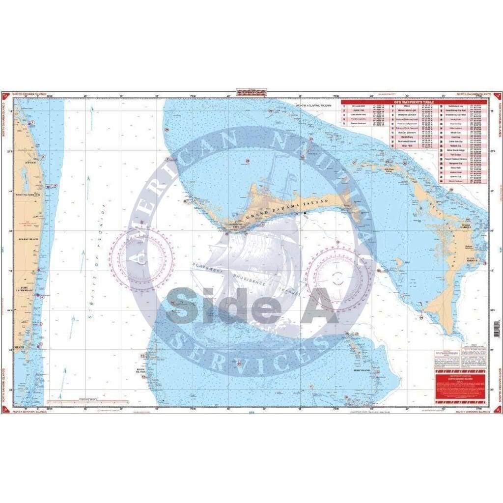
Side A is an enlarged projection of Florida’s South East Coast from Stuart south to Elliot Key and east to include the Abacos Islands and south to include the Bimini and Berry Islands. Side B includes South Florida, Cuba, and the Bahama Islands south and east to the northwest coast of Haiti. This is a great chart for planning your trip to the Abacos or anywhere in the Bahamas. This Chart of the Bahamas needs to be in your Chart Drawer. Side A is an enlarged projection of Florida’s South East Coast from Stuart south to Elliot Key and east to include the Abacos Islands and south to include the Bimini and Berry Islands. Side B includes South Florida, Cuba, and the Bahama Islands south and east to the northwest coast of Haiti. This is a great navigation chart for planning your trip to the Abacos or anywhere in the Bahamas. You will be able to expertly journey from Florida to the Bahamas with ease. The illustrations and vibrant colors make this navigation map excellent for framing and hanging on the wall. Information from NOAA Charts #411 and #11013. Nautical Chart is 25″ X 38″. WGS84 – World Mercator Datum.
Side A is an enlarged projection of Florida’s South East Coast from Stuart south to Elliot Key and east to include the Abacos Islands and south to include the Bimini and Berry Islands. Side B includes South Florida, Cuba, and the Bahama Islands south and east to the northwest coast of Haiti. This is a great chart for planning your trip to the Abacos or anywhere in the Bahamas. This Chart of the Bahamas needs to be in your Chart Drawer. Side A is an enlarged projection of Florida’s South East Coast from Stuart south to Elliot Key and east to include the Abacos Islands and south to include the Bimini and Berry Islands. Side B includes South Florida, Cuba, and the Bahama Islands south and east to the northwest coast of Haiti. This is a great navigation chart for planning your trip to the Abacos or anywhere in the Bahamas. You will be able to expertly journey from Florida to the Bahamas with ease. The illustrations and vibrant colors make this navigation map excellent for framing and hanging on the wall. Information from NOAA Charts #411 and #11013. Nautical Chart is 25″ X 38″. WGS84 – World Mercator Datum.
Original : $346,000.00
-70%$346,000.00
$103,800.00Description
Side A is an enlarged projection of Florida’s South East Coast from Stuart south to Elliot Key and east to include the Abacos Islands and south to include the Bimini and Berry Islands. Side B includes South Florida, Cuba, and the Bahama Islands south and east to the northwest coast of Haiti. This is a great chart for planning your trip to the Abacos or anywhere in the Bahamas. This Chart of the Bahamas needs to be in your Chart Drawer. Side A is an enlarged projection of Florida’s South East Coast from Stuart south to Elliot Key and east to include the Abacos Islands and south to include the Bimini and Berry Islands. Side B includes South Florida, Cuba, and the Bahama Islands south and east to the northwest coast of Haiti. This is a great navigation chart for planning your trip to the Abacos or anywhere in the Bahamas. You will be able to expertly journey from Florida to the Bahamas with ease. The illustrations and vibrant colors make this navigation map excellent for framing and hanging on the wall. Information from NOAA Charts #411 and #11013. Nautical Chart is 25″ X 38″. WGS84 – World Mercator Datum.


