NOAA Nautical Chart 1116ANWOG: Atchafalaya Bay to Sabine Pass (Oil and Gas Leasing Areas)
Description
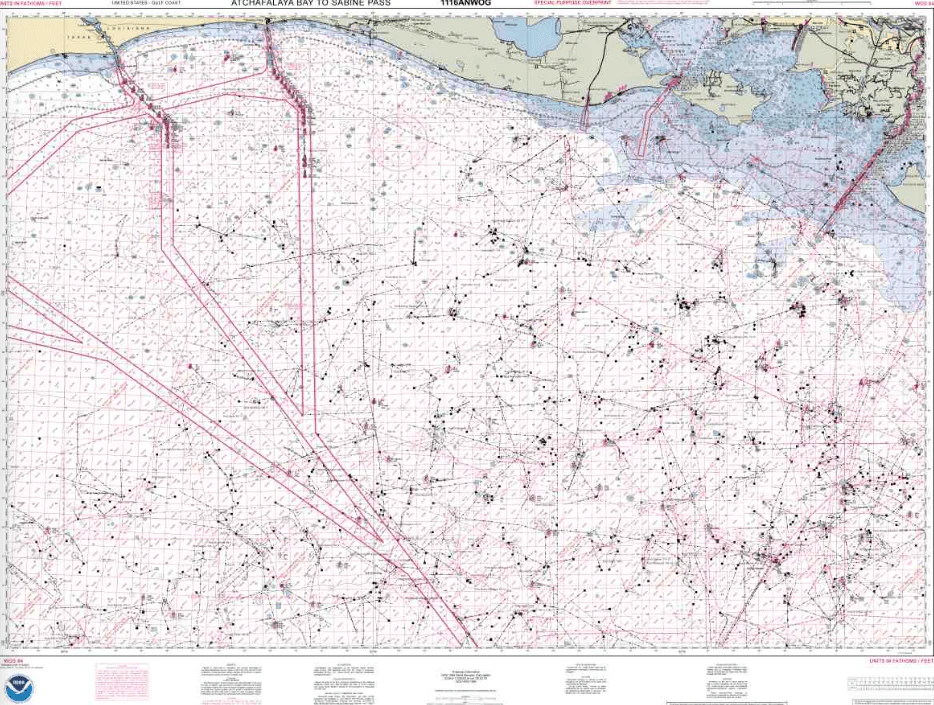
NOAA Nautical Chart 1116ANWOG: Atchafalaya Bay to Sabine Pass (Oil and Gas Leasing Areas) is a standard navigation chart used by commercial and recreational mariners alike. Printed on-demand on water-resistant paper, this chart meets the definition of a nautical chart in SOLAS Chapter V Regulation 2.2 and satisfies carriage requirements in SOLAS Chapter V Regulation 19.2.1.4.
-
NOAA Custom Chart (For Navigation)
- Created using the NOAA Custom Chart (NCC) application.
- Contains all the up-to-date information found in ENCs.
- Printed directly from the NOAA Custom Chart Application.
- Navigation Ready – meets current standards for maritime navigation.
- [View in Nautical Chart Viewer]
Printing & Material
- On-demand printing ensures the latest available version at the time of order.
- Water-resistant paper for durability in marine environments.
Additional Information
NOAA Custom Chart (Updated)
Scale: 250000
Paper Size: 36.0" x 49.0"
Actual Chart Size: 46.5" x 35.2"
Description
NOAA Nautical Chart 1116ANWOG: Atchafalaya Bay to Sabine Pass (Oil and Gas Leasing Areas) is a standard navigation chart used by commercial and recreational mariners alike. Printed on-demand on water-resistant paper, this chart meets the definition of a nautical chart in SOLAS Chapter V Regulation 2.2 and satisfies carriage requirements in SOLAS Chapter V Regulation 19.2.1.4.
-
NOAA Custom Chart (For Navigation)
- Created using the NOAA Custom Chart (NCC) application.
- Contains all the up-to-date information found in ENCs.
- Printed directly from the NOAA Custom Chart Application.
- Navigation Ready – meets current standards for maritime navigation.
- [View in Nautical Chart Viewer]
Printing & Material
- On-demand printing ensures the latest available version at the time of order.
- Water-resistant paper for durability in marine environments.
Additional Information
NOAA Custom Chart (Updated)
Scale: 250000
Paper Size: 36.0" x 49.0"
Actual Chart Size: 46.5" x 35.2"
Original : $27.95
-70%$27.95
$8.38Description
Description
NOAA Nautical Chart 1116ANWOG: Atchafalaya Bay to Sabine Pass (Oil and Gas Leasing Areas) is a standard navigation chart used by commercial and recreational mariners alike. Printed on-demand on water-resistant paper, this chart meets the definition of a nautical chart in SOLAS Chapter V Regulation 2.2 and satisfies carriage requirements in SOLAS Chapter V Regulation 19.2.1.4.
-
NOAA Custom Chart (For Navigation)
- Created using the NOAA Custom Chart (NCC) application.
- Contains all the up-to-date information found in ENCs.
- Printed directly from the NOAA Custom Chart Application.
- Navigation Ready – meets current standards for maritime navigation.
- [View in Nautical Chart Viewer]
Printing & Material
- On-demand printing ensures the latest available version at the time of order.
- Water-resistant paper for durability in marine environments.
Additional Information
NOAA Custom Chart (Updated)
Scale: 250000
Paper Size: 36.0" x 49.0"
Actual Chart Size: 46.5" x 35.2"


