Marquesas Dry Tortugas Offshore Fish and Dive Chart 8F
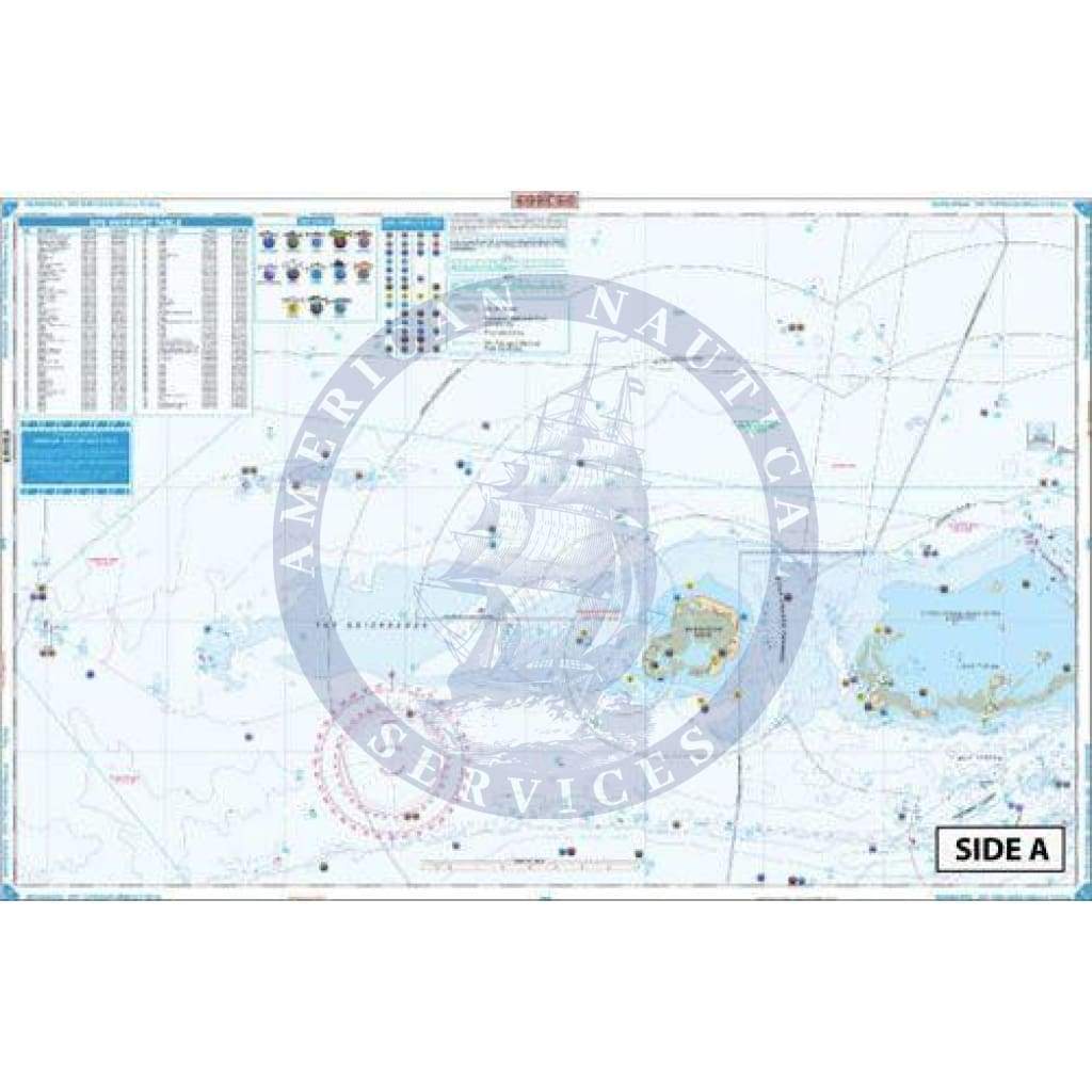
Coverage from Sand Key and the Northwest Channel (west of Key West) west to Rebecca Shoal on the east side. Offshore inset on west side shows passage from Rebecca Shoal to the Dry Tortugas. Detailed coverage of the Dry Tortugas on the west side with blow up of Tortugas Harbor and Fort Jefferson. 187 Plotted and Indexed GPS Positions for reefs and wrecks, lights, fishing and diving sites. Added color highlights shallow areas and enhanced contour line defines 60′ curves. No Dry Tortugas fishing trip is complete without this highly detailed fishing chart. Coverage runs from Sand Key and the Northwest Channel (west of Key West) west to Rebecca Shoal on the east side. Offshore inset on the west side shows passage from Rebecca Shoal to the Dry Tortugas. Detailed coverage of the Dry Tortugas on the west side with blow up of Tortugas Harbor and Fort Jefferson. There are 187 Plotted and Indexed GPS Positions for reefs and wrecks, lights, fishing and diving sites. To make this the best fishing chart available, we have also included popular areas for catching local species. These species include mahi mahi, sailfish, and more. Added color highlights shallow areas and enhanced contour line defines 60 foot curves. Commemorate your trip to the Dry Tortugas with framed nautical charts. Information from 3 NOAA Charts: #11439, #11438, #11434. Nautical Chart is 25″ X 38″. WGS84 – World Mercator Datum.
Coverage from Sand Key and the Northwest Channel (west of Key West) west to Rebecca Shoal on the east side. Offshore inset on west side shows passage from Rebecca Shoal to the Dry Tortugas. Detailed coverage of the Dry Tortugas on the west side with blow up of Tortugas Harbor and Fort Jefferson. 187 Plotted and Indexed GPS Positions for reefs and wrecks, lights, fishing and diving sites. Added color highlights shallow areas and enhanced contour line defines 60′ curves. No Dry Tortugas fishing trip is complete without this highly detailed fishing chart. Coverage runs from Sand Key and the Northwest Channel (west of Key West) west to Rebecca Shoal on the east side. Offshore inset on the west side shows passage from Rebecca Shoal to the Dry Tortugas. Detailed coverage of the Dry Tortugas on the west side with blow up of Tortugas Harbor and Fort Jefferson. There are 187 Plotted and Indexed GPS Positions for reefs and wrecks, lights, fishing and diving sites. To make this the best fishing chart available, we have also included popular areas for catching local species. These species include mahi mahi, sailfish, and more. Added color highlights shallow areas and enhanced contour line defines 60 foot curves. Commemorate your trip to the Dry Tortugas with framed nautical charts. Information from 3 NOAA Charts: #11439, #11438, #11434. Nautical Chart is 25″ X 38″. WGS84 – World Mercator Datum.
Original : $346,000.00
-70%$346,000.00
$103,800.00Description
Coverage from Sand Key and the Northwest Channel (west of Key West) west to Rebecca Shoal on the east side. Offshore inset on west side shows passage from Rebecca Shoal to the Dry Tortugas. Detailed coverage of the Dry Tortugas on the west side with blow up of Tortugas Harbor and Fort Jefferson. 187 Plotted and Indexed GPS Positions for reefs and wrecks, lights, fishing and diving sites. Added color highlights shallow areas and enhanced contour line defines 60′ curves. No Dry Tortugas fishing trip is complete without this highly detailed fishing chart. Coverage runs from Sand Key and the Northwest Channel (west of Key West) west to Rebecca Shoal on the east side. Offshore inset on the west side shows passage from Rebecca Shoal to the Dry Tortugas. Detailed coverage of the Dry Tortugas on the west side with blow up of Tortugas Harbor and Fort Jefferson. There are 187 Plotted and Indexed GPS Positions for reefs and wrecks, lights, fishing and diving sites. To make this the best fishing chart available, we have also included popular areas for catching local species. These species include mahi mahi, sailfish, and more. Added color highlights shallow areas and enhanced contour line defines 60 foot curves. Commemorate your trip to the Dry Tortugas with framed nautical charts. Information from 3 NOAA Charts: #11439, #11438, #11434. Nautical Chart is 25″ X 38″. WGS84 – World Mercator Datum.


