Maptech Waterproof Chartbook: Upper Chesapeake Bay, 2nd Edition
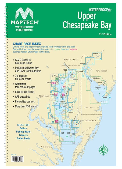
Covers C&D Canal to Solomons Island and includes Delaware Bay and River to Philadelphia. Offers full-color charts on waterproof, tear-resistant pages. Easy-to-use format includes GPS waypoints, pre-plotted courses and more than 450 marinas. 70 chart pages. 12 X 17". WATERPROOF!
Covers C&D Canal to Solomons Island and includes Delaware Bay and River to Philadelphia. Offers full-color charts on waterproof, tear-resistant pages. Easy-to-use format includes GPS waypoints, pre-plotted courses and more than 450 marinas. 70 chart pages. 12 X 17". WATERPROOF!
Original : $72.95
-70%$72.95
$21.89Description
Covers C&D Canal to Solomons Island and includes Delaware Bay and River to Philadelphia. Offers full-color charts on waterproof, tear-resistant pages. Easy-to-use format includes GPS waypoints, pre-plotted courses and more than 450 marinas. 70 chart pages. 12 X 17". WATERPROOF!


