Lake Michigan, 1st Edition
Explore the vast beauty of Lake Michigan with our detailed Lake Michigan map, 1st Edition by Richardson's Maptech. This expertly crafted map provides comprehensive coverage from the iconic city of Chicago all the way to the Straits of Mackinac, including the scenic region of Green Bay. Designed for avid adventurers and casual explorers alike, this map is a must-have for anyone planning to navigate or admire the stunning landscapes around Lake Michigan.
Key features of the Lake Michigan map include:
- Polyconic projection at 1:300,000 on one side that ensures accuracy across different regions.
- Mercator projection at 1:460,000 on the reverse side, providing a broader perspective of the area.
Measuring 24" x 36", this large format map is perfect for framing or using as a functional guide during your explorations. Whether you're fishing, boating, or simply enjoying the beautiful shoreline, this map equips you with all the geographical details you need.
The vibrant colors and clear labels make it easy to identify landmarks, cities, and natural features. This Lake Michigan map is not just a tool; it’s a gateway to adventure in one of the most stunning freshwater lakes in America.
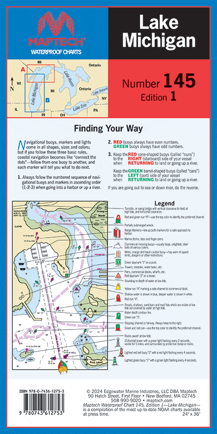
Description
Explore the vast beauty of Lake Michigan with our detailed Lake Michigan map, 1st Edition by Richardson's Maptech. This expertly crafted map provides comprehensive coverage from the iconic city of Chicago all the way to the Straits of Mackinac, including the scenic region of Green Bay. Designed for avid adventurers and casual explorers alike, this map is a must-have for anyone planning to navigate or admire the stunning landscapes around Lake Michigan.
Key features of the Lake Michigan map include:
- Polyconic projection at 1:300,000 on one side that ensures accuracy across different regions.
- Mercator projection at 1:460,000 on the reverse side, providing a broader perspective of the area.
Measuring 24" x 36", this large format map is perfect for framing or using as a functional guide during your explorations. Whether you're fishing, boating, or simply enjoying the beautiful shoreline, this map equips you with all the geographical details you need.
The vibrant colors and clear labels make it easy to identify landmarks, cities, and natural features. This Lake Michigan map is not just a tool; it’s a gateway to adventure in one of the most stunning freshwater lakes in America.


