Key West and Lower Keys Lobster Inshore Fish and Dive Chart 110F
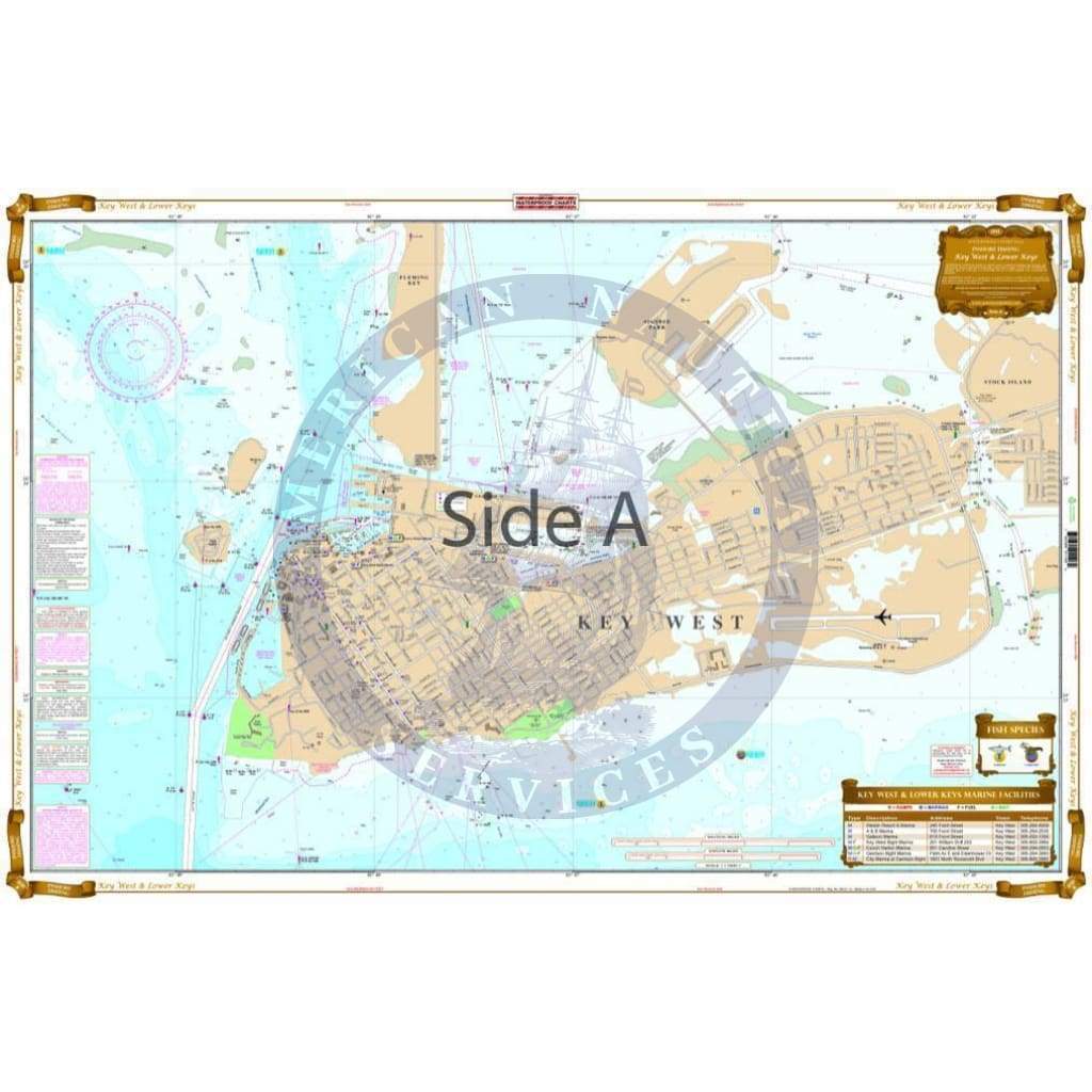
Coverage from the 7 mile bridge west to Key West. Offshore to the reef and North to the Content Keys and Upper Harbor Key. This chart shows all the inshore fishing locations for the popular fish caught in this area as well as popular boat routes If you are in search of Bonefish, Permit, Snook, Redfish, Trout, or Tarpon, you are going to want this chart. This new chart also includes GPS coordinates where Lobsters can be caught. The reverse side is a blowup of Key West with street detail, marinas, boat ramps, restaurants, bars, hotels, and points of interest. If you are headed to the Lower Keys and Key West, this is a must have chart. No trip to the Florida Keys is complete without this Florida Keys map. Coverage runs from the 7 mile bridge west to Key West, offshore to the reef and north to the Content Keys and Upper Harbor Key. This navigation chart shows all the inshore fishing locations for the popular fish caught in this area as well as popular boat routes If you are in search of Bonefish, Permit, Snook, Redfish, Trout, or Tarpon, you are going to want this fishing chart. This new nautical map also includes GPS coordinates where lobsters can be caught during Florida Keys lobster season. The reverse side is a blowup of Key West with street detail, marinas, boat ramps, restaurants, bars, hotels, and points of interest. If you are headed to the Lower Keys and Key West, this is a must have marine map. Commemorate your trip to the Florida Keys with a framed navigation map of this area. Nautical Chart is 25″ X 38″. WGS84 – World Mercator Datum.
Coverage from the 7 mile bridge west to Key West. Offshore to the reef and North to the Content Keys and Upper Harbor Key. This chart shows all the inshore fishing locations for the popular fish caught in this area as well as popular boat routes If you are in search of Bonefish, Permit, Snook, Redfish, Trout, or Tarpon, you are going to want this chart. This new chart also includes GPS coordinates where Lobsters can be caught. The reverse side is a blowup of Key West with street detail, marinas, boat ramps, restaurants, bars, hotels, and points of interest. If you are headed to the Lower Keys and Key West, this is a must have chart. No trip to the Florida Keys is complete without this Florida Keys map. Coverage runs from the 7 mile bridge west to Key West, offshore to the reef and north to the Content Keys and Upper Harbor Key. This navigation chart shows all the inshore fishing locations for the popular fish caught in this area as well as popular boat routes If you are in search of Bonefish, Permit, Snook, Redfish, Trout, or Tarpon, you are going to want this fishing chart. This new nautical map also includes GPS coordinates where lobsters can be caught during Florida Keys lobster season. The reverse side is a blowup of Key West with street detail, marinas, boat ramps, restaurants, bars, hotels, and points of interest. If you are headed to the Lower Keys and Key West, this is a must have marine map. Commemorate your trip to the Florida Keys with a framed navigation map of this area. Nautical Chart is 25″ X 38″. WGS84 – World Mercator Datum.
Original : $27.95
-70%$27.95
$8.38Description
Coverage from the 7 mile bridge west to Key West. Offshore to the reef and North to the Content Keys and Upper Harbor Key. This chart shows all the inshore fishing locations for the popular fish caught in this area as well as popular boat routes If you are in search of Bonefish, Permit, Snook, Redfish, Trout, or Tarpon, you are going to want this chart. This new chart also includes GPS coordinates where Lobsters can be caught. The reverse side is a blowup of Key West with street detail, marinas, boat ramps, restaurants, bars, hotels, and points of interest. If you are headed to the Lower Keys and Key West, this is a must have chart. No trip to the Florida Keys is complete without this Florida Keys map. Coverage runs from the 7 mile bridge west to Key West, offshore to the reef and north to the Content Keys and Upper Harbor Key. This navigation chart shows all the inshore fishing locations for the popular fish caught in this area as well as popular boat routes If you are in search of Bonefish, Permit, Snook, Redfish, Trout, or Tarpon, you are going to want this fishing chart. This new nautical map also includes GPS coordinates where lobsters can be caught during Florida Keys lobster season. The reverse side is a blowup of Key West with street detail, marinas, boat ramps, restaurants, bars, hotels, and points of interest. If you are headed to the Lower Keys and Key West, this is a must have marine map. Commemorate your trip to the Florida Keys with a framed navigation map of this area. Nautical Chart is 25″ X 38″. WGS84 – World Mercator Datum.


