Florida to Puerto Rico and Mona Passage Navigation Chart 16
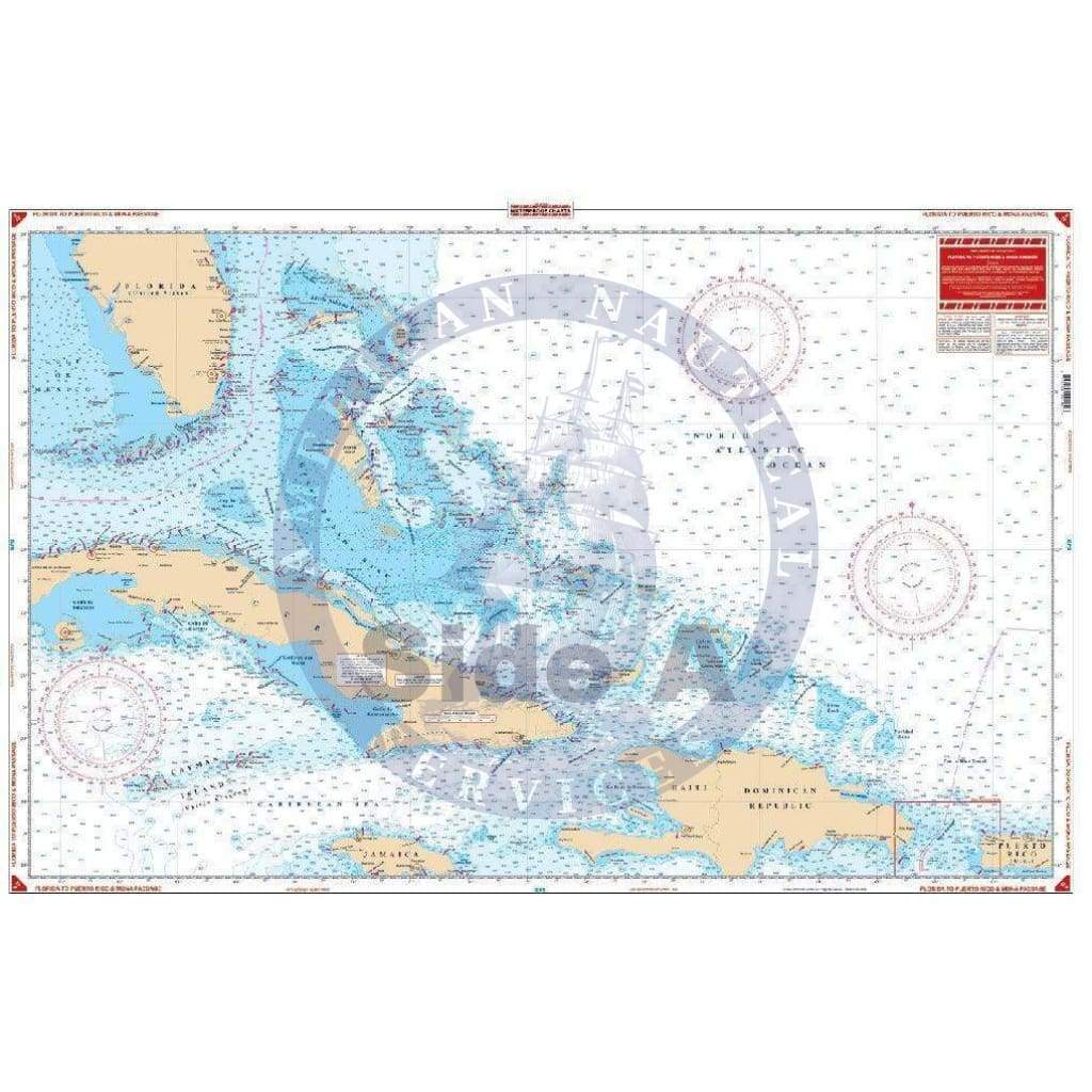
This offshore navigation chart shows the area from mid Florida to Western Puerto Rico on side A. Includes Hispanola, Turks and Caicos Islands, Jamaica, Cayman Islands and the entire Bahama chain. Side B covers Mona Passage, between Hispanola and Puerto Rico, and shows the Island of Mona and the Mayaguez and Boqueron areas east to Ensenada. If you plan to head across the Florida Straits, you’re in luck! These marine maps offer an overhead view from the tip of South Florida down to the Caribbean. This offshore navigation chart shows the area from mid Florida to Western Puerto Rico on side A. Includes Hispanola, Turks and Caicos Islands, Jamaica, Cayman Islands and the entire Bahama chain. Side B covers Mona Passage, between Hispanola and Puerto Rico, and shows the Island of Mona and the Mayaguez and Boqueron areas east to Ensenada.
Information from 2 DMA Charts: #27005 & #25700. Nautical chart is 25″ X 38″. WGS84 – World Mercator Datum.
Original : $2,400.00
-70%$2,400.00
$720.00Description
This offshore navigation chart shows the area from mid Florida to Western Puerto Rico on side A. Includes Hispanola, Turks and Caicos Islands, Jamaica, Cayman Islands and the entire Bahama chain. Side B covers Mona Passage, between Hispanola and Puerto Rico, and shows the Island of Mona and the Mayaguez and Boqueron areas east to Ensenada. If you plan to head across the Florida Straits, you’re in luck! These marine maps offer an overhead view from the tip of South Florida down to the Caribbean. This offshore navigation chart shows the area from mid Florida to Western Puerto Rico on side A. Includes Hispanola, Turks and Caicos Islands, Jamaica, Cayman Islands and the entire Bahama chain. Side B covers Mona Passage, between Hispanola and Puerto Rico, and shows the Island of Mona and the Mayaguez and Boqueron areas east to Ensenada.
Information from 2 DMA Charts: #27005 & #25700. Nautical chart is 25″ X 38″. WGS84 – World Mercator Datum.


