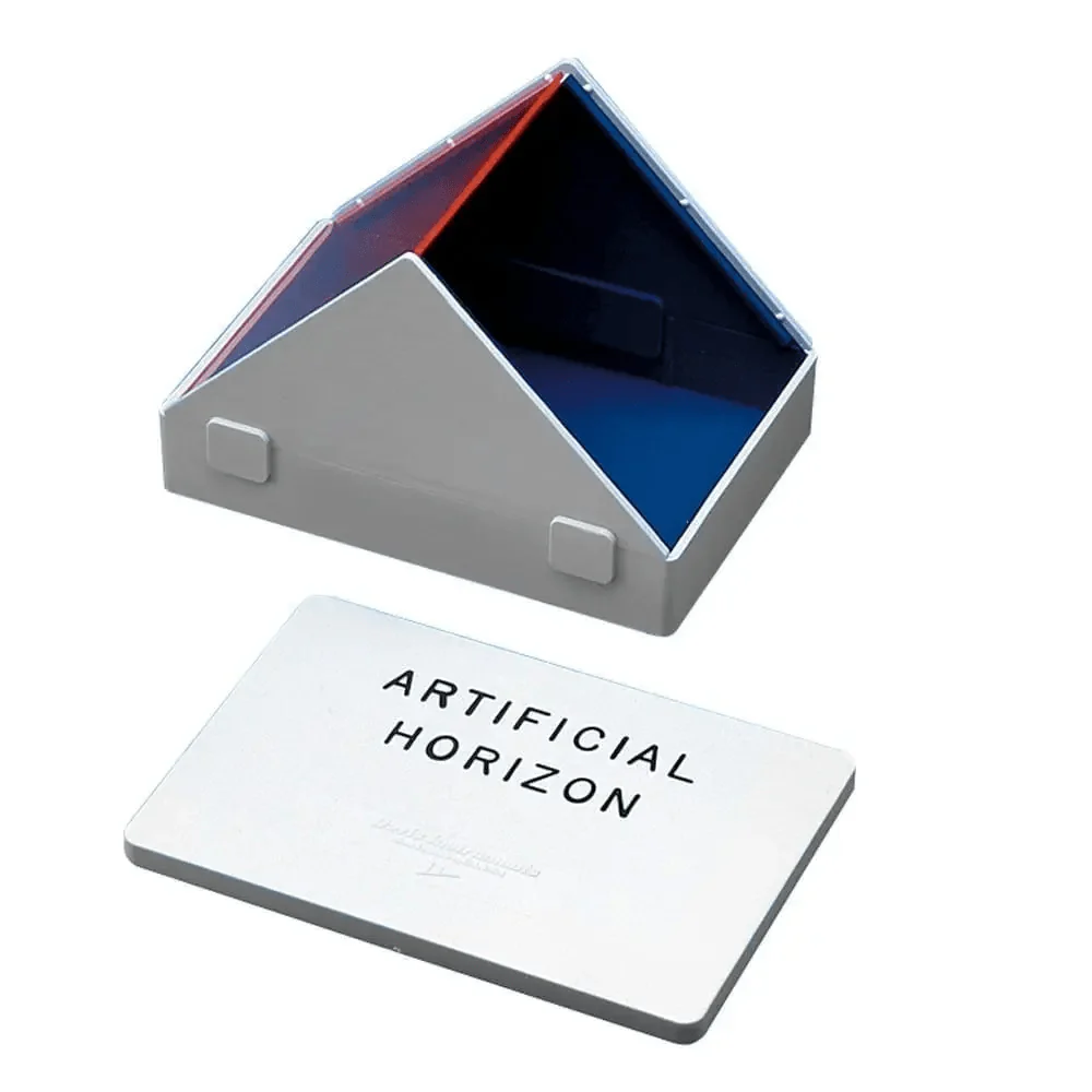
Davis Artificial Horizon
The Davis Artificial Horizon is an inexpensive instrument made entirely of plastic and glass. The body is filled with water to provide a reflecting surface which is shielded from the wind by two transparent covers. It comes with four sunshades and complete instructions. After use it folds up into a small hand sized package. SW 1 lb.
ABOUT ARTIFICIAL HORIZONS
Artificial horizons were used by sailors of sailing ships when they were becalmed. This condition was frequently accompanied by fog which obscured the natural horizon. A tray of mercury was used, and the image of the actual body was superimposed with the image reflected by the mercury. Half the angle was used as the sextant altitude. This method worked at sea only because the ship was essentially motionless.
Today, artificial horizons are used by those wanting to use or practice celestial navigation inland. There are two kinds of artificial horizons to be had: a bubble attachment for the sextant, and the flat artificial horizon shown on this page. Actually, some people have luck with a simple pie pan of motor oil if conditions are not windy. There are two major drawbacks involved with the flat artificial horizon: it is difficult to use with stars, and actual altitudes are limited to about 60° (half the range of the sextant). Therefore, every effort should be made to acquire a natural horizon rather than resorting to a flat artificial one. The Practice Bubble Horizon is most effective for practice because it allows the sextant to be used in a normal manner (ie. not pointed at the ground).
The DIP SHORT table (reprinted from a 1919 issue of Bowditch) is shown here for your convenience. It will allow you to correct for the use of lakes, rivers, and even ponds as natural horizons. It gives an effective dip correction to use when sighting above an opposite bank, or the waterline of another boat.
| Dip of the sea at different Distances from the Observer. | |||||||||||||||||||||||||||||||||||||||||||
| Dist. of | Land in | Sea Miles | Height of the eye above the Sea in Feet. | ||||||||||||||||||||||||||||||||||||||||
| 5 | 10 | 15 | 20 | 25 | 30 | 35 | 40 | ||||||||||||||||||||||||||||||||||||
| 1/4 | 1/2 | 3/4 | 1 | ‘ | 11 | 6 | 4 | 3 | ‘ | 23 | 12 | 8 | 6 | ‘ | 34 | 17 | 12 | 9 | ‘ | 45 | 23 | 15 | 12 | ‘ | 57 | 28 | 19 | 15 | ‘ | 68 | 34 | 23 | 17 | ‘ | 79 | 40 | 27 | 20 | ‘ | 91 | 45 | 30 | 23 |
| 1 1/4 | 1 1/2 | 2 | 2 1/2 | 3 | 3 | 2 | 2 | 5 | 4 | 4 | 3 | 7 | 6 | 5 | 4 | 10 | 8 | 7 | 6 | 12 | 10 | 8 | 7 | 14 | 12 | 9 | 8 | 16 | 14 | 11 | 9 | 19 | 16 | 12 | 10 | ||||||||
| 3 | 3 1/2 | 4 | 5 | 2 | 2 | 2 | 2 | 3 | 3 | 3 | 3 | 4 | 4 | 4 | 4 | 5 | 5 | 5 | 4 | 6 | 6 | 5 | 5 | 7 | 6 | 6 | 6 | 8 | 7 | 7 | 6 | 9 | 8 | 7 | 7 | ||||||||
| 6 | 2 | 3 | 4 | 4 | 5 | 5 | 6 | 6 |
Original : $39.95
-70%$39.95
$11.99Description
The Davis Artificial Horizon is an inexpensive instrument made entirely of plastic and glass. The body is filled with water to provide a reflecting surface which is shielded from the wind by two transparent covers. It comes with four sunshades and complete instructions. After use it folds up into a small hand sized package. SW 1 lb.
ABOUT ARTIFICIAL HORIZONS
Artificial horizons were used by sailors of sailing ships when they were becalmed. This condition was frequently accompanied by fog which obscured the natural horizon. A tray of mercury was used, and the image of the actual body was superimposed with the image reflected by the mercury. Half the angle was used as the sextant altitude. This method worked at sea only because the ship was essentially motionless.
Today, artificial horizons are used by those wanting to use or practice celestial navigation inland. There are two kinds of artificial horizons to be had: a bubble attachment for the sextant, and the flat artificial horizon shown on this page. Actually, some people have luck with a simple pie pan of motor oil if conditions are not windy. There are two major drawbacks involved with the flat artificial horizon: it is difficult to use with stars, and actual altitudes are limited to about 60° (half the range of the sextant). Therefore, every effort should be made to acquire a natural horizon rather than resorting to a flat artificial one. The Practice Bubble Horizon is most effective for practice because it allows the sextant to be used in a normal manner (ie. not pointed at the ground).
The DIP SHORT table (reprinted from a 1919 issue of Bowditch) is shown here for your convenience. It will allow you to correct for the use of lakes, rivers, and even ponds as natural horizons. It gives an effective dip correction to use when sighting above an opposite bank, or the waterline of another boat.
| Dip of the sea at different Distances from the Observer. | |||||||||||||||||||||||||||||||||||||||||||
| Dist. of | Land in | Sea Miles | Height of the eye above the Sea in Feet. | ||||||||||||||||||||||||||||||||||||||||
| 5 | 10 | 15 | 20 | 25 | 30 | 35 | 40 | ||||||||||||||||||||||||||||||||||||
| 1/4 | 1/2 | 3/4 | 1 | ‘ | 11 | 6 | 4 | 3 | ‘ | 23 | 12 | 8 | 6 | ‘ | 34 | 17 | 12 | 9 | ‘ | 45 | 23 | 15 | 12 | ‘ | 57 | 28 | 19 | 15 | ‘ | 68 | 34 | 23 | 17 | ‘ | 79 | 40 | 27 | 20 | ‘ | 91 | 45 | 30 | 23 |
| 1 1/4 | 1 1/2 | 2 | 2 1/2 | 3 | 3 | 2 | 2 | 5 | 4 | 4 | 3 | 7 | 6 | 5 | 4 | 10 | 8 | 7 | 6 | 12 | 10 | 8 | 7 | 14 | 12 | 9 | 8 | 16 | 14 | 11 | 9 | 19 | 16 | 12 | 10 | ||||||||
| 3 | 3 1/2 | 4 | 5 | 2 | 2 | 2 | 2 | 3 | 3 | 3 | 3 | 4 | 4 | 4 | 4 | 5 | 5 | 5 | 4 | 6 | 6 | 5 | 5 | 7 | 6 | 6 | 6 | 8 | 7 | 7 | 6 | 9 | 8 | 7 | 7 | ||||||||
| 6 | 2 | 3 | 4 | 4 | 5 | 5 | 6 | 6 |


