1 / 2
Stonington to Mount Desert Island Waterproof Chart, 3rd Edition
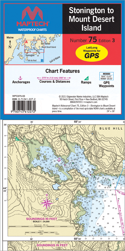
This chart covers the myriad islands, harbors, and passages from Eggemoggin Reach and Eastern Penobscot Bay to Bar Harbor. Features: waypoints for major buoys, courses and distances, and ramp locations. 24" x 36", scale 1:47,000, with insets.
This chart covers the myriad islands, harbors, and passages from Eggemoggin Reach and Eastern Penobscot Bay to Bar Harbor. Features: waypoints for major buoys, courses and distances, and ramp locations. 24" x 36", scale 1:47,000, with insets.
$8.38
Original : $27.95
-70%Stonington to Mount Desert Island Waterproof Chart, 3rd Edition—
$27.95
$8.38Description
This chart covers the myriad islands, harbors, and passages from Eggemoggin Reach and Eastern Penobscot Bay to Bar Harbor. Features: waypoints for major buoys, courses and distances, and ramp locations. 24" x 36", scale 1:47,000, with insets.


