1 / 2
Lake Champlain Waterproof Chart, 3rd Edition
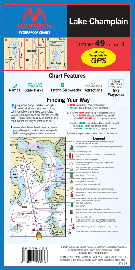
Whitehall, NY to the Richelieu River, Quebec. Featuring GPS Waypoints, state parks, ramp locations and information, and VT/NY border. 24" x 36", scale 1:57,000 with insets.
Whitehall, NY to the Richelieu River, Quebec. Featuring GPS Waypoints, state parks, ramp locations and information, and VT/NY border. 24" x 36", scale 1:57,000 with insets.
$8.38
Original : $27.95
-70%Lake Champlain Waterproof Chart, 3rd Edition—
$27.95
$8.38Description
Whitehall, NY to the Richelieu River, Quebec. Featuring GPS Waypoints, state parks, ramp locations and information, and VT/NY border. 24" x 36", scale 1:57,000 with insets.


