San Francisco Bay Waterproof Chart, 3rd Edition
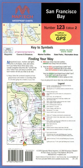
Covers the middle and southern Bay from Richmond to Palo Alto. Featuring GPS waypoints, pre-plotted courses and distances, 42 marine facilities with service information, state and federal parks. 24" x 36", scales 1:26,666 and 1:80,000 with insets.
Covers the middle and southern Bay from Richmond to Palo Alto. Featuring GPS waypoints, pre-plotted courses and distances, 42 marine facilities with service information, state and federal parks. 24" x 36", scales 1:26,666 and 1:80,000 with insets.
Original : $27.95
-70%$27.95
$8.38Description
Covers the middle and southern Bay from Richmond to Palo Alto. Featuring GPS waypoints, pre-plotted courses and distances, 42 marine facilities with service information, state and federal parks. 24" x 36", scales 1:26,666 and 1:80,000 with insets.


