Abaco Island Chart (Navigation Chart 24" x 36")
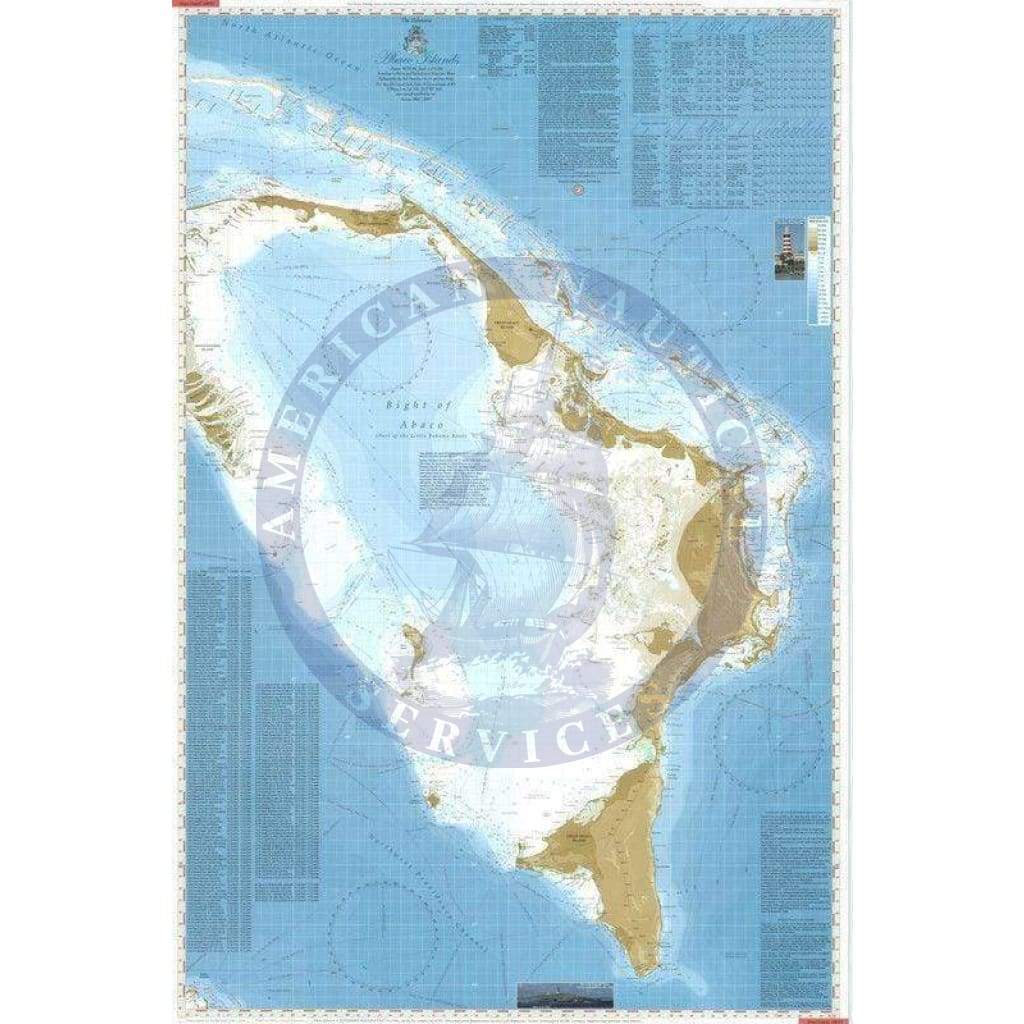
Front side covers Great and Little Abaco Islands and nearby Cays from North Fish Cays to Hole in the Wall.
Reverse features 21 detailed plans of reef channels and popular harbours and anchorages. Also includes:
- 190+ waypoints
- Marina Directory
- Pilotage notes and “need to know” information
- Routes through Sea of Abaco and Abaco Bight
- Safe routes between Cays and Barrier Reef
- Major Cuts from Sea of Abaco to the Atlantic Ocean.
$6.58
Original : $21.95
-70%Abaco Island Chart (Navigation Chart 24" x 36")—
$21.95
$6.58Description
Front side covers Great and Little Abaco Islands and nearby Cays from North Fish Cays to Hole in the Wall.
Reverse features 21 detailed plans of reef channels and popular harbours and anchorages. Also includes:
- 190+ waypoints
- Marina Directory
- Pilotage notes and “need to know” information
- Routes through Sea of Abaco and Abaco Bight
- Safe routes between Cays and Barrier Reef
- Major Cuts from Sea of Abaco to the Atlantic Ocean.


